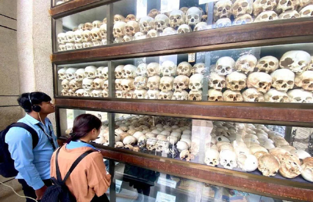
Cambodia Information
Cambodia Geography
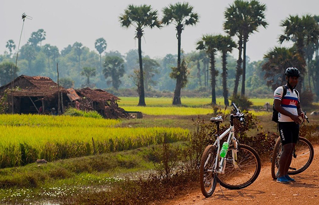
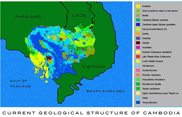
Cambodia is a country in Southeastern Asia, bordering the Gulf of Thailand, between Thailand, Vietnam, and Laos. Its approximate geographical coordinates are 11°N 104°E. Its 2,572 km border is split among Vietnam (1,228 km), Thailand (803 km) and Laos (541 km), as well as 443 km of coastline. Cambodia covers 181,040 square kilometres in the southwestern part of the Indochina peninsula. It lies completely within the tropics; its southernmost points are only slightly more than 10° above the equator. Roughly square in shape, the country is bounded on the north by Thailand and by Laos, on the east and southeast by Vietnam, and on the west by the Gulf of Thailand and by Thailand. Much of the country's area consists of rolling plains. Dominant features are the large, almost centrally located, Tonle Sap (Great Lake) and the Mekong River, which traverses the country from north to south and is the 12th longest river in the world.
The climate is monsoonal and has marked wet and dry seasons of relatively equal length. Both temperature and humidity generally are high throughout the year. Forest covers about two-thirds of the country, but it has been somewhat degraded in the more readily accessible areas by burning (a method called slash-and-burn agriculture), and by shifting agriculture.
Topography in Cambodia
Cambodia falls within several well-defined geographic regions. The largest part of the country, about 75 percent, consists of the Tonle Sap Basin and the Mekong Lowlands. To the southeast of this great basin is the Mekong Delta, which extends through Vietnam to the South China Sea. The basin and delta regions are rimmed with mountain ranges to the southwest by the Cardamom Mountains and the Elephant Range and to the north by the Dangrek Mountains. Higher land to the northeast and to the east merges into the Central Highlands of southern Vietnam.
The Tonle Sap Basin-Mekong Lowlands region consists chiefly of plains with elevations generally of less than 100 meters. As the elevation increases, the terrain becomes more rolling and dissected.
The Cardamom Mountains in the southwest, oriented generally in a northwest-southeast direction, rise to more than 1,500 meters. The highest mountain in Cambodia--Phnom Aural, at 1,771 meters—is in the eastern part of this range. The Elephant Range, an extension running toward the south and the southeast from the Cardamom Mountains, rises to elevations of between 500 and 1,000 meters. These two ranges are bordered on the west by a narrow coastal plain that contains Kampong Saom Bay, which faces the Gulf of Thailand. This area was largely isolated until the opening of the port of Kampong Saom (formerly called Sihanoukville) and the construction of a road and railroad connecting Kampong Saom, Kampot, Takev, and Phnom Penh in the 1960s.
The Dangrek Mountains at the northern rim of the Tonle Sap Basin consist of a steep escarpment with an average elevation of about 500 meters, the highest points of which reach more than 700 meters. The escarpment faces southward and is the southern edge of the Korat Plateau in Thailand. The watershed along the escarpment marks the boundary between Thailand and Cambodia. The main road through a pass in the Dangrek Mountains at O Smach connects northwestern Cambodia with Thailand. Despite this road and those running through a few other passes, in general the escarpment impedes easy communication between the two countries. Between the western part of the Dangrek and the northern part of the Cardamom ranges, however, lies an extension of the Tonle Sap Basin that merges into lowlands in Thailand, which allows easy access from the border to Bangkok.
The Mekong Valley, which offers a communication route between Cambodia and Laos, separates the eastern end of the Dangrek Mountains and the northeastern highlands. To the southeast, the basin joins the Mekong Delta, which, extending into Vietnam, provides both water and land communications between the two countries.
Cambodia Climate & Weather
Cambodia's climate, like that of the rest of Southeast Asia is dominated by monsoons, which are known as tropical wet and dry because of the distinctly marked seasonal differences. The monsoonal airflows are caused by annual alternating high pressure and low pressure over the Central Asian landmass. In summer, moisture-laden air—the southwest monsoon—is drawn landward from the Indian Ocean. . The flow is reversed during the winter, and the northeast monsoon sends back dry air. The southwest monsoon brings the rainy season from mid-May to mid-September or to early October, and the northeast monsoon flow of drier and cooler air lasts from early November to March. The southern third of the country has a two-month dry season; the northern two-thirds, a four-month one. Short transitional periods, which are marked by some difference in humidity but by little change in temperature, intervene between the alternating seasons. Temperatures are fairly uniform throughout the Tonle Sap Basin area, with only small variations from the average annual mean of around 25 °C (77.0 °F). The maximum mean is about 28.0 °C (82.4 °F); the minimum mean, about 22.98 °C (73.36 °F). Maximum temperatures of higher than 32 °C (89.6 °F), however, are common and, just before the start of the rainy season, they may rise to more than 38 °C (100.4 °F). Minimum temperatures rarely fall below 10 °C (50 °F). January is the coolest month, and April is the warmest. Tropical cyclones that often devastate coastal Vietnam rarely cause damage in Cambodia.
The total annual rainfall average is between 1,000 and 1,500 millimeters (39.4 and 59.1 in), and the heaviest amounts fall in the southeast. Rainfall from April to September in the Tonle Sap Basin-Mekong Lowlands area averages 1,300 to 1,500 millimeters (51.2 to 59.1 in) annually, but the amount varies considerably from year to year. Rainfall around the basin increases with elevation. It is heaviest in the mountains along the coast in the southwest, which receive from 2,500 millimeters (98.4 in) to more than 5,000 millimeters (196.9 in) of precipitation annually as the southwest monsoon reaches the coast. This area of greatest rainfall, however, drains mostly to the sea; only a small quantity goes into the rivers flowing into the basin. The relative humidity is high at night throughout the year; usually it exceeds 90 percent. During the daytime in the dry season, humidity averages about 50 percent or slightly lower, but it may remain about 60 percent in the rainy period.
Drainage of Cambodia
Except for the smaller rivers in the southeast, most of the major rivers and river systems in Cambodia drain into the Tonle Sap or into the Mekong River. The Cardamom Mountains and Elephant Range form a separate drainage divide. To the east the rivers flow into the Tonle Sap, while on the west they flow into the Gulf of Thailand. Toward the southern end of the Elephant Mountains, however, because of the topography, some small rivers flow southward on the eastern side of the divide.
The Mekong River in Cambodia flows southward from the Cambodia-Laos border to a point below Kracheh city, where it turns west for about 50 kilometers and then turns southwest to Phnom Penh. Extensive rapids run above Kracheh city. From Kampong Cham the gradient slopes very gently, and inundation of areas along the river occurs at flood stage—June through November—through breaks in the natural levees that have built up along its course. At Phnom Penh four major water courses meet at a point called the Chattomukh (Four Faces). The Mekong River flows in from the northeast and the Tonle Sab—a river emanating from the Tonle Sap—flows in from the northwest. They divide into two parallel channels, the Mekong River proper and the Basak River, and flow independently through the delta areas of Cambodia and Vietnam to the South China Sea.
The flow of water into the Tonle Sap is seasonal. In September or in October, the flow of the Mekong River, fed by monsoon rains, increases to a point where its outlets through the delta cannot handle the enormous volume of water. At this point, the water pushes northward up the Tonle Sab and empties into the Tonle Sap, thereby increasing the size of the lake from about 2,590 square kilometers to about 24,605 square kilometers at the height of the flooding. After the Mekong's waters crest—when its downstream channels can handle the volume of water—the flow reverses, and water flows out of the engorged lake.
As the level of the Tonle Sap retreats, it deposits a new layer of sediment. The annual flooding, combined with poor drainage immediately around the lake, transforms the surrounding area into marshlands unusable for agricultural purposes during the dry season. The sediment deposited into the lake during the Mekong's flood stage appears to be greater than the quantity carried away later by the Tonle Sap River. Gradual silting of the lake would seem to be occurring; during low-water level, it is only about 1.5 meters deep, while at flood stage it is between 10 and 15 meters deep.


.jpg)